


Measuring Spatiotemporal Changes in Forest Ecosystem Research Infrastructure
The lack of methods to characterize tree structure over time has been limiting our understanding on tree growth allocation and wood density.
The SCAN FOREST research infrastructure brings forth the vision that within the next 30 years the society will be able to understand the functions of forest ecosystems in a comprehensive manner. To solve this challenge, the development of external tree architecture obtained using terrestrial laser scanning (TLS), mobile laser scanning (MLS) and and airborne laser scanning (ALS) will be linked to wood density and its variation and used to quantitatively understand tree growth allocation. The key technologies needed to achieve the goals include annually acquired TLS and MLS data combined with high-quality ALS data with point density of several hundreds, or even thousands of points per m2. By adding multi- modal and -temporal dimensions and linking these to the existing theories on tree physiology, SCAN FOREST users can reliably build the missing link from external structural observations to the internal wood quality properties. The SCAN FOREST will include approximately 10,000 individual trees measured with laser scanning at an unprecedented level of detail. For method development and for validation of the targeted solutions, about 2,000 trees will be measured with wood density samples using X-Ray microdensitometry at a 3-year interval.
The foundations of the SCAN FOREST consist of the following elements:
A) Mobile laser scanning infrastructure for tree measurements
B) Laser scanning change monitoring infrastructure
C) X-Ray microdensitometer
D) Test site and key characteristics of trees that will be derived for each tree within sample plots and for each year using LS time series and X-Ray microdensitometer.
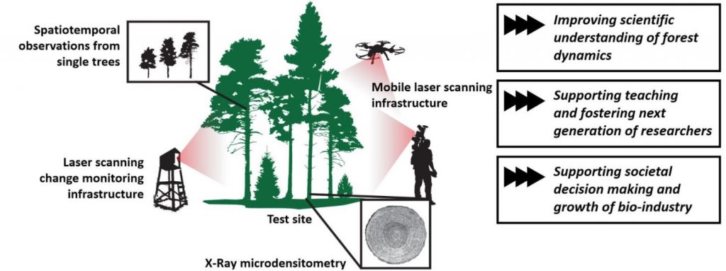
Illustrative description of the concept of the SCAN FOREST infrastructure.